Tuesday, April 22, 2014

How to Train for Cedro Peak (in Retrospect)

A few days ago Zeke Tiernan and I managed to duck out for a quick 17 mile outing up the Porcupine Rim Trail in Moab, UT. It had been one week since I ran the Cedro Peak 45 miler in Albuquerque, NM. As we climbed up the rocky terrain of the trail, I couldn't help but think doing more of these runs would have prepared me more adequately for Cedro.

The race had started off fine as I ran along with my good friend Brendan Trimboli for the first few miles before having to duck into the woods for a pit stop. I would spend the rest of the race chasing after Brendan. After a bout of projectile vomiting and nearly bonking on some gnarly climbs, I realized I hadn't done the proper homework for this particular race. So I'm here to give you the do's and don'ts on how to train/run Cedro Peak.

1. Do - As many trail runs as you can that offer some rocky/technical sections. Cedro runs through the Cibola National Forest, an area that has plenty of rocky sections you are going to want to be prepared for.

2. Don't - Run on the road and avoid trails like the plague. Finding as flat a road as possible to work on pure speed probably isn't going to help you much.

3. Do - As many desert runs as possible. It's an early season race, and as comfortable as you can get in slightly warmer conditions the better off you are going to be.

4. Don't - Eat the spiciest burger you can find the night before at Nob Hill. Eat there the night AFTER you've raced.

5. Do - Practice as much harder down hill running as possible to prepare your quads for the NET downhill the first 27 miles of Cedro. Be sure to also practice going up steeper climbs later in your long runs as the second half of the race has all of the climbing.

Cedro was an amazing time. On paper the course looks much easier than it actually is. The second half offers a very technical and gnarly climb up a power line section and a second ascent of Cedro Peak. Be prepared for this after 27 miles of some hard downhill and you'll be much happier.

One of the hard climbs later in the race 

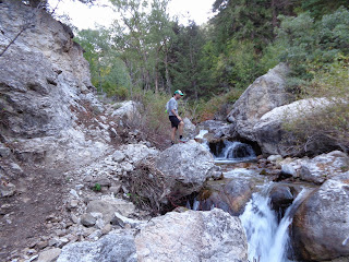
Going downhill at Cedro

 Zeke climbing at Porcupine Rim Trail in Moab

More climbing at Porcupine 

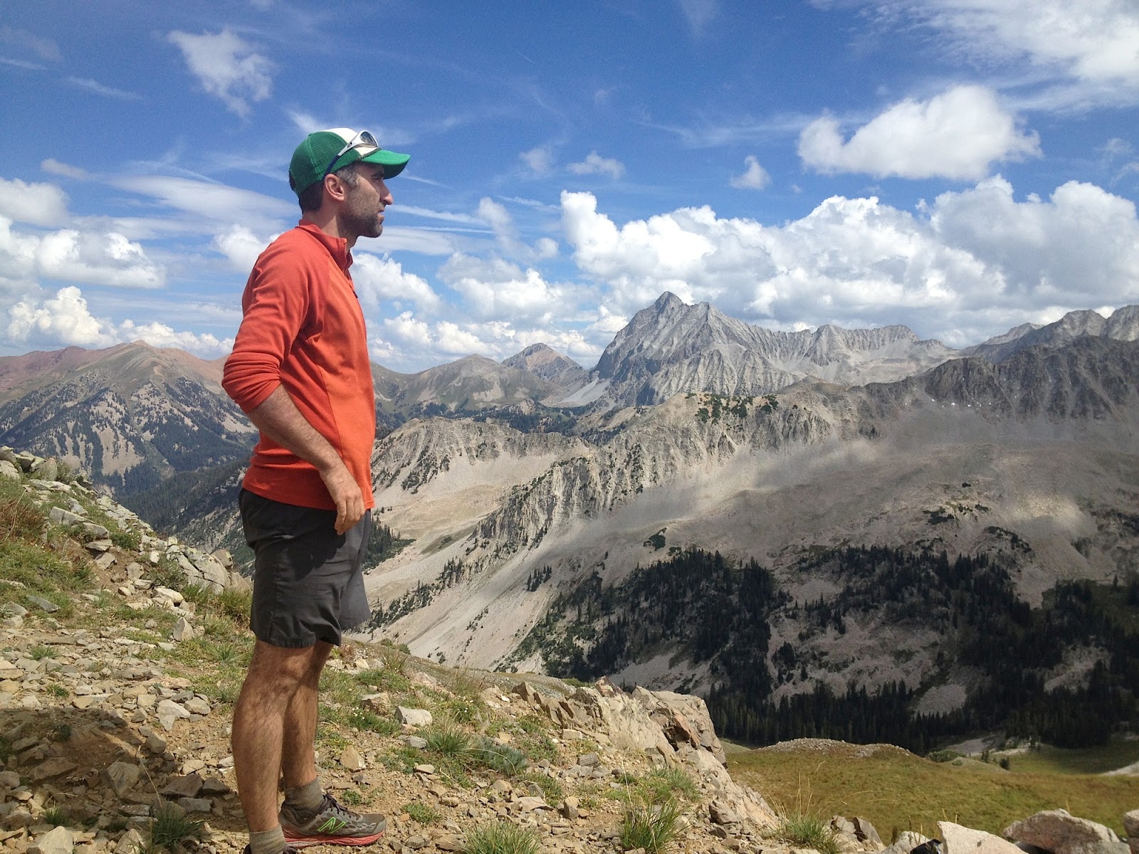
 Me realizing my legs are still tired a week later


Saturday, March 8, 2014

Stepping Back in Time

 
I was sitting in front of a cast-iron furnace pulling glacial mounds of ice out of my beard. It was -7 outside, but I was managing to stay somewhat warm in the concrete structure on Mary Ann Miller's farm property just outside of Atoka, OK.
 
I thought back to 30 minutes prior, when I was running through the woods of Mary Ann's property headed back to the finish . I had just signed the sheet at the last check-in table, which was also one of the self-help aid stations out on the course. On the dirt road headed back I saw Ruben Aguilar coming up on his way to the last check-in. He was about 4 minutes behind. I had the privilege to run much of the first 17 miles with him. We yelled encouragement to each other as we passed.
 
Two hours ago we went through the start/finish area to complete our first of two laps. The temperature was dropping rapidly and it was becoming harder to get water out of our freezing bottles. I smashed my bottle against a tree to break off the ice so I could top it off. I asked if there were any extra GU's around. Mary Ann thought I said juice, and asked if I liked Apple.
 
A little over 4 hours ago Matt and I arrived at the property where I would run my first race of the season, a low-key 50K directed by Mary Ann. Run almost entirely on her property, the course is a mix of rocky and technical single-track, fast two-track and some dirt road. Everything about the event was Old School. A throw-back to the way ultra running was in its pioneering days. I'd heard from folks about how ultra races used to organized group runs with a clipboard at the beginning and end. You write your own time down and that was it. I would find out later from my brother that while I was out on the course, Mary Ann told tale of how ultra running used to be. While she was telling my brother this, she was showing me.
 
Snapping back to the present, I realized we needed to head out to get a jump on the ensuing ice storm. I grabbed my bottle of red wine, the spoils of the day (I would later have to use a screw driver, a screw and a vice-grip to pry the cork off), and thanked Mary Ann as we headed out. I told my brother as we walked back to the car that we had just spent the morning back in time, and it was a real pleasure.
 
                      (Enjoy some pics from the day. All photos courtesy of Mike Langille)

 
beginning of the race around the lake

finishing up the run


Monday, January 6, 2014

In the Land of Big Foot

"I'd run with a camera if I were you. You're in Big Foot country!"

"What?" I look over at Harold, our camp ground host. He's been talking to me for over 30 minutes. My girlfriend and I are in Talimena State Park, 3 days into our New Year's road trip.

"Yes sir. There are signs of his existence everywhere."

"Well, maybe I'll be the one to finally catch him."

"You might just be." Harold says in a very serious tone.

Alrighty....I had choosen the Winding Stair Mountain and Ouachita Mountain recreation areas that sit between Talahina, OK and Mena, AR as the destination for our annual road trip. There were many reasons for my choice. Here are 3.

1) I grew up in Moore, OK just 4 hours down the road and had never explored this particular area of the state.

2) I have this unexplicable desire to see parts of the Ouachita Trail, a trail extending over 200 miles from Oklahoma to Arkansas that begins in this region.

3) There is a very difficult Fat Ass-style trail marathon in Mena, AR the first weekend of January called the Athens Big Fork Trail Marathon.

We started off our trip with a quick detour to the Tall Grass Prairie National Preserve. I had read that there are 40-ish miles of backcountry prairie trails on the preserve. Luckily for us, the day we got there it was 18 degrees with violent gusts of 25 mph wind. Lyssa and I started our run wearing two pieces of head gear and four shirts.

"See! This isn't that bad. This is what I grew up running in everyday!" I yelled as a gust knocked the wind out of me. After splitting up, I realized the map I had tucked into my waistbelt had blown out and I ended up getting lost in a sea of prairie field sameness for an extra 30 minutes. Lyssa and I both agreed that was one of the most surreal terrains we'd ever run through.

After talking with Harold, I stepped onto mile 1 of the Ouachita Trail and did a quick 6 miles on the first bit of the trail. It was highly technical, hilly and very secluded. I didn't end up doing the race for numerous reasons, but I was still looking for some satisfaction. Something I hadn't had with my running since my 100 mile attempt. On the last day of our trip, as I ran back to the car off the top of Winding Stair Mountain, I felt a sense of play I hadn't felt in awhile. As we drove away I knew I would be back here again someday. There was a lot more playing to be had in this area...and I still hadn't seen Big Foot.

Special Note:

-Mena, AR is in a dry county! We didn't know this and had a snarky checkout lady at a grocery store brag to us that there were no liquor stores in the area. "You gots to go 2 hours in any direction if you want alcohol". Luckily, someone was watching over us and the box of wine in the backseat of our car still had some gifts.


a trailhead marker along the Tall Grass Prairie trails


the high point of the Prairie Fire Loop


Potato Hill vista 2.5 miles into the Ouachita Trail


the god of boxed wine saves us on New Year's Eve in dry county, AR


a white blaze marking the route along the Horsethief Spring Trail


running up toward Snake Mountain


Atop Snake Mountain on the Horsethief Spring Trail


Traversing from Winding Stair Mountain to Rough Mountain


climbing back up Winding Stair Mountain


Rough Mountain to the left


Oklahoma wildlife

Friday, November 22, 2013

Pass Mountain 50K and Beyond

After spending an entire summer preparing for the 100 mile attempt that didn't pan out, i've been dealing with gallons of disappointment. After talking it over with my GF Lyssa, it was decided the best thing might be to get back in the saddle one last time before the winter fully settled in. After a few weeks of no running and another few weeks of very low mileage, i flew out to Phoenix to take part in the Pass Mountain 50K.

Pass Mountain is part of Aravaipa Racing's Winter Desert Series, put on by the Coury brothers, Nick and Jamil. Both seasoned runners, their race direction is a well-oiled machine and this race course was top notch. 

i don't like overly lengthy race reports, so i'll just say it probably isn't very smart to race 5 weeks after your body experiences an epic blow-up that took place because you were playing mad scientist with your body's chemistry. i will take the time to say this -- i liked the course. we were treated to an epic sunrise as we meandered through the desert floor and the single-track through the Tonto National Forest was really NEAT. The course's variety surprised me with a good portion of technical footing through Tonto as well as an enjoyable mid-lap climb.

As for the race itself, i took off too fast and led the first bit before i was sucked back up into a group of 3 other fellas. the four of us were together for the first of two laps, and then my body hit its current limit. i think i heard Schwartzenegger's voice from terminator 2 say "the vehicle has reached it's maximum speed" in my head. i slowed 'er down and jogged it on in for 4th.

i recommend putting this race on your radar. It was a hoot. i also recommend drinking 4 or 5 Kilt Raiser Scottish Ales at Four Peaks in the Phoenix Airport before your flight.

Now, it's on to winter.

This winter will be spent hiking, swiss-bobbing, skiing, snow-shoeing, and swimming. The running i will do will be in preparation for the Monumental Link-up, a running project i will tackle next year that will link all of the trails in the Colorado National Monument in a single running.

Enjoy some pics below of last weekend's race, all courtesy of Aravaipa Running's website.

start of the course

about two miles into the course, racing like a moron

entering the Tonto National Forest

finishing up lap 1 of 2...feeling like a pile of GIANT DOO DOO


Friday, October 11, 2013

Got Sodium...The Arkansas Traveller 100 attempt


strike 2! last weekend i went on down to Arkansas for my second 100 mile attempt. last year at the Javalina Jundred, I foolishly tried running 100 miles 4 weeks after a hard run at a 50 miler. the result was my MCL blowing up at mile 60. this year i did it right, training hard for a full 6-to-8 weeks leading up to the Arkansas Traveller 100. i was feeling fit and ready, as well as good and nervous the week of. i won't bore with tons of detail, but i was on pace to go around 18 to 19 hours and sitting comfortably in 3rd place when my body started reacting in a very peculiar way. we discovered later that i had taken in too much sodium and not enough water, transforming my body into a convulsing, smashed wreck that i had no control over. i had to drop at mile 84.

despite the obvious disappointment, there were some important details that i took away from the experience. here are 11 of them.

1-i got to experience life as a noodle for about 3 hours.

2-i can now say that it has taken me 2 hours to walk a mile.

3-go to SIMS Barbeque in Little Rock! the place has been around since 1937 and you might cry when
   you bite into the beef sandwich. it's that good!

4-the 8 miles of singletrack on the Ouachita Trail at the AT100 are awesome. as was the race
    direction and organization. i highly recommend the race to those wanting a late season 100 miler.

5-the folks at Fleet Feet Easy Runner are super nice peeps.

6-my family is awesome.

7-my friends Morgan and Ryan are awesome, too.

8-my girlfriend Lyssa is something special.

9-my beard is hot in 90 percent humidity.

10-forget 100's. next year i'm going back to focusing on 50ks and mountain runs.

11-13,000+ mg of sodium in 70 miles does not do a body good.

My two favorite pics from the experience.


with Lyssa at mile 68-ish

surrounded by the fam and friends

Monday, September 23, 2013

does this trail have a name? no name...no trail!

This last weekend I caped off a summer of running with a route I've been keen on doing since I first moved to the Roaring Fork Valley almost 5 years ago. The route I'm referring to is the No Name Trail (sometimes referred to as Jessie Weaver Trail) up to the canyon top above Glenwood Springs and then down the Mitchell Creek Trail to the Glenwood Fish Hatchery.

The No Name Trail climbs approximately 5,000 ft in 8 miles onto the canyon top (The Flat Tops Wilderness Area) and dead ends at the Transfer Trail. From Glenwood there are two other access points onto the Flat Tops, one of which is Transfer Trail and the other is the more rugged Mitchell Creek Trail that starts at the town's Fish Hatchery.

On the Fall Equinox my partner in ridiculous pursuits Zeke Tiernan and I dropped a car shuttle off at the Mitchell Creek Trailhead and then began our climb up No Name. You may ask at this point if we celebrated Fall in style. We did. Zeke tripped over a rock 4 minutes in. Don't worry, I tripped over a stick about 30 seconds later. You can't celebrate autumn without a fall.....

The route was everything I could have hoped for and more. We climbed out of the canyon and into an alpine zone, and then we got lost. For an hour. If anyone ever repeats this route, please note to take a hard right down a hill about 5 minutes after seeing a sign for route # 635. Don't go down that route. We didn't. But we still had no idea where we were. The torrential rains from the late summer turned the trail into an overgrown jungle. If you want to know what the trail looks like, I suggest you take a giant leaf and put it over your face. We bushwhacked and second guessed ourselves about 5 times. The trail opens up about 3-ish miles from the Hatchery. Lucky for us, the sky also opened up and we were hounded with hail and rain for the rest of the run. About 4 miles from the finish, we lucked out and ran right into the thickest brush of stinging nettles in the United States. I was really happy to hit this patch as I love having really itchy legs. We didn't just brush up against the nettles. We were "in the shit" as they say.

The route ending up being a 5 hour outing, though the running was more around 4 hours. I look forward to exploring this area more next season. Below are some images from the route.


Zeke one mile into the route


4 miles up No Name. Canyon entrance is in the background

Zeker pushing through some brush halfway through No Name

a low bridge at the headwaters of the No Name creek make the crossing difficult in early season

Zeker heading into the alpine zone toward the top of the canyon

a really neat picure

Zeke checking the map on the Flat Tops

heading down Mitchell Creek 2 miles from the Hatchery

Wednesday, September 18, 2013

Avalanche Lolli-Pop Loop


two weekends ago my great buddy and training partner Zeke Tiernan and i checked off my final long outing before arkansas traveler. the loop was actually a lolli-pop style run starting at the avalanche creek trail head just off of highway 133 outside of carbondale. any time i'm in charge of picking the route, we usually end up bushwhacking at some point...we got to bushwhack. to achieve the loop, run 11 miles up avalanche, then make a right onto the silver creek trail. (there is good signage here.)

my girlfriend Lyssa was camping out with a group of kiddos for outdoor ed, so we were treated with a brief stop and some chatting with her about 2 and half hours in. We topped off our bladders and continued up the first of three passes. after gaining the first pass (Grassy Pass), you stay high for some amazing high alpine track, then you climb out of a small basin onto Silver Creek Pass. From there, it's a fast and furious descent down toward the town of Marble. at the base of Mt Arkansas, make a right at the bearded hunter laying next to a rock, and head up the north fork trail to avalanche pass.

avalanche pass is a bitch. the footing is rutted out and there is some over growth on the way up. once you are on the pass, head up to the right toward the high point another 200 feet. now this is where you get to have fun. time to bushwhack. the trail poops out 500 yards down the other side of the pass. the trail is a brown, dotted line on the map, which usually means it is a primitive or unmaintained trail. in this case it is a figment of the maps imagination. follow the creek about 2 hours back to avalanche and cross. then it's just 8 miles back down avalanche to the car and you're done!

in all seriousness, we had 9 hours of epic running and it was a great way to spend the day. here are some pictures from the day.